







When we hear the name Mississippi, the first image that comes to mind is a flat region in the US, slow, warm lands, cotton fields, and wide, lazy rivers. In fact, parts of the flatlands of the state sit low and stretch toward the horizon.Pictures are only as good as the places we’ve actually visited. Most of us form our ideas about an area from a few stories, a few road trips, and whatever the postcards chose to show. But the real hidden secrets are what make it actually beautiful and are worth exploring, sitting quietly off the main roads, waiting for a curious traveler to be discovered.
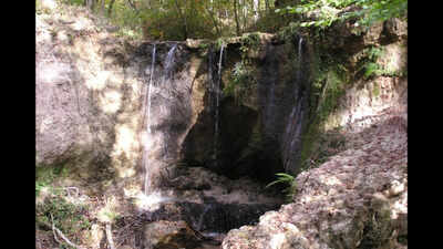
One such area is Clarks Creek, which is home to about 50 waterfalls sitting quietly in Mississippi, hidden amid the flatlands
Clark Creek Natural Area sits in the far southwest corner of Mississippi, near the Louisiana line. According to the Mississippi Department of Wildlife, Fisheries and Parks (MDWFP), the preserve was created in 1978, covers more than 700 acres, and is known for about 50 waterfalls between 10 and 30-plus feet tall. For a state people link with flat land, that comes as quite a surprise.
Why does the area look so different from Mississippi’s flatlands
The secret to the unique landscape lies in the loess, a fine silt that the wind carried here and piled up in thick layers during the ice age. It wears away quickly and cuts straight down, so the hills above these creeks are steep, and the water carves narrow, shaded ravines instead of wide, flat valleys.According to the Mississippi Land Conservation Assistance Network, the steep loess bluffs here support a mixed forest of hardwood and pine, mostly beech and magnolia.
The area houses unique flora and fauna
The area is also home to several uncommon trees, including serviceberry, umbrella tree, pyramid magnolia, and chinquapin oak. Visitors can also spot a rare land snail, the federally endangered Carolina magnolia vine, and a state-endangered fish.Apart from this, the forest is good habitat for black bears, which makes the waterfalls only part of the story; together, these details are why the place feels so different from the Mississippi most people imagine.
Is the hike easy or difficult?
There are two main paths, a developed trail and a primitive one. According to the Advocate in Baton Rouge, the hike ranges from about 1.78 to 2.6 miles, and calls the trip “an escape from the flat.”Most waterfalls depend on the amount of rainfall in the region, so the count of the number of waterfalls may vary depending upon the adequate amount of rainfall in the region.
How to plan your visit to Clarks Creek
The park’s address is 366 Fort Adams Pond Road in Woodville. According to MDWFP, visiting hours range between 8 a.m. and 5 p.m., and the day-use fee costs around $2-$4 per person, with children five and under admitted free.Visitors should plan their visit in advance, as the area remains closed on Monday and Tuesday, and carry sufficient drinking water, as there are only restrooms at the trailhead, so bring plenty.